What Is a Flash Drought, and Why Is North Carolina Living Through One
A dry, hot stretch of weeks has pushed North Carolina into its worst drought in nearly two decades, draining the Triangle region's main reservoirs along the way.
At Goodness Grows, a community garden Christus Victor Lutheran Church has run in Durham, North Carolina since 2018, the soil has stopped behaving like soil. "You can hear the crunch," volunteer Barb Trapp-Moen told ABC11, describing dry, brittle leaves that fill a bucket almost as fast as they're picked. Cucumbers, okra and tomatoes are wilting faster than usual and producing less. "It's not normal," she said.
North Carolina didn't slide into this slowly. Six weeks ago the state was coming off a wet spring. Now 90% of it sits in Severe to Exceptional Drought, and north-central North Carolina is registering Exceptional Drought, the most extreme category the U.S. Drought Monitor tracks, for the first time since March 2008. That kind of whiplash has a name: a flash drought.
What Is a Flash Drought?
A conventional drought builds over months or years, the way the American Southwest's multidecade dry stretch has. A flash drought does the same damage in weeks. Earth scientists describe it as the product of two forces arriving together: precipitation dropping well below normal at the same time temperatures spike, according to a Conversation explainer written by drought researchers. Higher heat raises what scientists call evaporative demand, essentially how "thirsty" the atmosphere is for moisture. When rain is plentiful, soil can keep up with that thirst. When it isn't, the land dries out fast, and a drier surface then pushes air temperatures even higher, a feedback loop that intensifies itself.
North Carolina's version fits the pattern almost exactly. The state just had its second-driest January-through-May on record, going back to 1895, and June brought little relief statewide even as neighboring Georgia and Alabama caught a wetter pattern. That combination, a long-term deficit compounding a short, sharp dry spell, is what pushed the Triangle region into Exceptional Drought so fast.
Why Is Jordan Lake So Low Right Now?
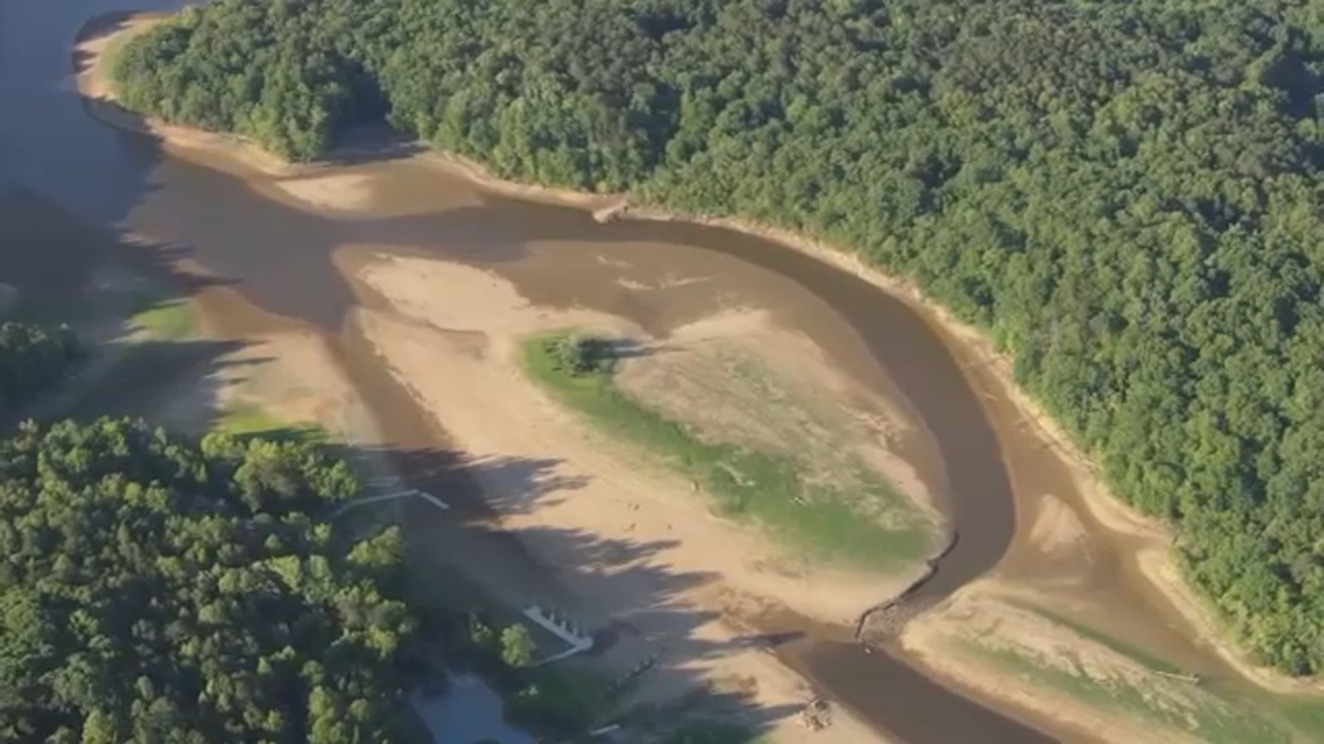
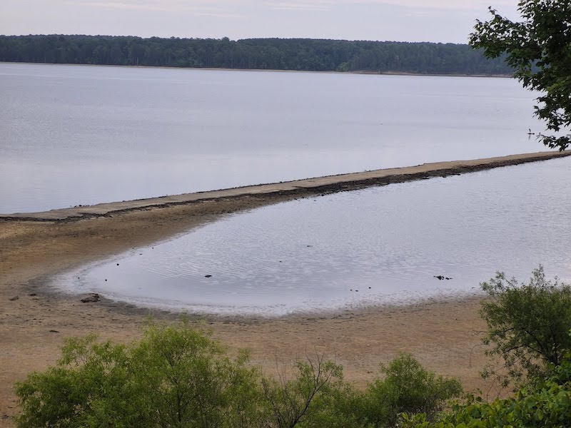
The most visible sign of the crisis sits at Jordan Lake, a major water source for North Carolina's Triangle region. Federal drought officials describe the reservoir as sitting below its target storage elevation, with broad stretches of shoreline exposed and old, long-submerged roads reappearing as boating hazards. Falls Lake, another Triangle-area reservoir, is in the same condition.
Durham has felt the squeeze directly. "Our lakes are very low. The region is in exceptional drought," James Lim, the city's water efficiency program manager, told ABC11. With its own reservoir, Lake Michie, running critically low, Durham is now paying the neighboring town of Cary to pump and treat water drawn from Jordan Lake, a stopgap Lim says the city doesn't yet have the infrastructure to access on its own. Sprinkler systems are banned under the city's current restrictions, and water officials warn that without meaningful rain, Durham could move to even stricter Stage 3 limits within months.
Georgia, Alabama and the Florida Panhandle received more than 175% of their normal rainfall in May, according to federal drought trackers, proof that flash drought isn't a regional sentence so much as a local roll of the dice. Meanwhile South Florida is dealing with its own version: Lake Okeechobee sits near a water-shortage threshold, the Everglades are running dangerously dry, and active wildfires have already forced road closures in the Florida Peninsula.
Why Didn't Anyone See This Coming?
Partly because flash droughts are genuinely hard to forecast. Conventional drought monitoring leans on long-run temperature and rainfall trends, tools built for changes that unfold over seasons. Flash droughts move on a timescale of weeks, much closer to ordinary weather variability, which is chaotic enough that forecasters generally won't project confidently beyond about 10 days. Boston's own whiplash is a case in point: a wet 2021 summer gave almost no warning of the sharp, damaging flash drought that hit New England the very next year.
Newer monitoring tools that track evaporative demand directly, rather than waiting for rainfall deficits to show up in the record, are giving farmers and water utilities a bit more lead time than they had a decade ago. That's cold comfort for North Carolina this summer. Federal forecasters expect near- to below-normal rainfall and above-normal heat through early July, and the same strengthening El Niño pattern that's pointing toward a quieter Atlantic hurricane season is also expected to suppress the tropical rainfall the Southeast normally counts on each fall to break droughts like this one. For Jordan Lake and the gardens that depend on what falls from the sky above it, the relief valve most years have relied on may simply not show up in 2026.